Awards
Digital Initiative Zurich (DIZH) Fellowship from ZHAW
Beatrix Emo received the external pageDigital Initiative Zurich (DIZH) Fellowship from ZHAW which commenced October 2020.
Beatrix' main project is the dissemination of a digital platform for socio-spatial tools
Digital spatial tools are useful to evaluate proposals for urban development and transformation in terms of their likely impact on society. This project proposes a novel digital platform to disseminate such spatial tools amongst relevant stakeholders (architects, planners, developers, local authorities, scientists and the public).
MIT Technology Review Award for Leonel Aguilar as Innovator Under 35 for Latin America
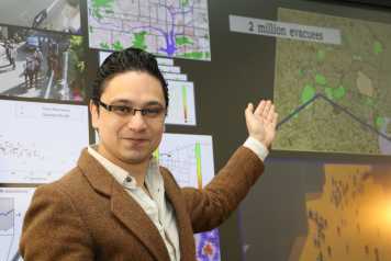
Leonel Aguilar was selected as an external pageInnovator Under 35 for Latin America by MIT Technology Review. This event sparked additional coverage to his research endeavours from Forbes Latin America, Fortune (in Spanish) as well as other news outlets. Leonel provided the following invited lectures: "An interactive introduction to Data Science for Engineers" at the INSPIRE Training school, ETH Zurich; “A conversation on Data Science and AI” for San Carlos University Guatemala; “From Compartimental Models to Agent Based Models, a practical tour on modelling and simulation” for CONVERCIENCIA 2020 event Guatemala. Additionally, Leonel provided the keynote talk “Computational Avatars in Virtual Worlds to quantify scenarios in urban planning and construction” for the Guatemalan Construction Chamber.
Congressi Stefano Francini Award: Best contribution, International Conference on Human Behavior in Design.
How the design of a building and its indoor-maps influences users’ experiences during navigation.
PhD candidate Verena Schnitzler won the best paper award on the HBid conference in Ascona, October 14-17, 2014.
Abstract:
In this study, we compared navigation through a large, complex, public building a) without any map, b) with a printed map, or c) with a digital map. Participants looked for five different destinations while thinking aloud and answered open questions about the wayfinding task and questionnaires about the building and maps. A content analysis was used in order to identify key factors in the bulding’s and maps’ design that facilitated or hindered successful and satisfactory usage. There was a significant search time difference between the no map group and the two other groups, but there were no differences in efficient building use between the two map groups. The analysis of the questionnaires exhibited a similar pattern. The destinations with their different characteristics elicited different numbers of comments regarding the difficulties people experienced. People using paper maps reported significantly less frequently to not have difficulties with the wayfinding task. The groups did not appear to apply different wayfinding strategies, suggesting that participants’ strategy choices were shaped by individual preferences and the building itself with its signage as an additional informative layer.